Environmental Justice of Urban Flood Risk and Green Infrastructure Solutions
The Environmental Justice of Urban Flood Risk and Green Infrastructure Solutions project aims to better understand the environmental justice impacts of climate change related flooding on minority and low-income communities and assess social equity in green infrastructure planning for reducing urban flood risks.
About the Project
As US cities face growing challenges to secure safety and security in the context of increasing climate change impacts including heat waves, coastal storms, and urban flooding there is a need to prepare for more frequent and intense extreme weather events and to understand the environmental justice implications related to the distribution of these climate-driven events.
The Environmental Justice of Urban Flood Risk and Green Infrastructure Solutions project aims to better understand the environmental justice considerations of climate change, related to urban flooding in vulnerable communities across 4 U.S. cities. The project will assess how social vulnerability varies across differently exposed communities and how this knowledge could inform green infrastructure planning.
This project is co-led by the Urban Systems Lab Research Fellow Pablo Herreros Cantis and Director Timon McPhearson with support from the Kresge Crews Program and in collaboration with Groundwork Hudson Valley.
Introduction
Cities and stormwater
Extreme precipitation is projected to increase in frequency and intensity around the country due to climate change. Urban areas are especially vulnerable to extreme precipitation due to the presence of impervious surfaces that avoid water from infiltrating. This leads to higher amounts of stormwater that need to be managed by the city's sewer systems, which can lead to flooding and/or water quality issues when combined sewers overflow and discharge untreated water to streams. Both issues may combine, for example with sewage backups that can cause the streets to flood with a combination of stormwater and untreated sewage.
Observed Change in Very Heavy Precipitation. The map shows percent increases in the amount of precipitation falling in very heavy events (defined as the heaviest 1% of all daily events) from 1958 to 2012 for each region of the continental United States. These trends are larger than natural variations for the Northeast, Midwest, Puerto Rico, Southeast, Great Plains, and Alaska. The trends are not larger than natural variations for the Southwest, Hawai‘i, and the Northwest. The changes shown in this figure are calculated from the beginning and end points of the trends for 1958 to 2012. (Figure source: updated from Karl et al. 2009).
Green infrastructure
Green infrastructure is emerging as a powerful tool to mitigate the risks posed by stormwater in a decentralized manner. Green infrastructure can be used to retain or slow down stormwater so that the load on sewer systems is reduced, lowering the risk of combined sewer overflows.
There are many ways to plan and design green infrastructure, as well as many ways to define it. While it can be used to deliver a wide variety of benefits, such as providing shade in hot days, or green spaces for communities to gather, green infrastructure is most commonly defined as a tool for stormwater management. While it can be used for mitigating flood risk and combined sewer overflows, the latter use is usually given much more importance than the first. These considerations affect how green infrastructure is designed and in what parts of the city it will be prioritized.
Environmental justice of flood risk and green infrastructure
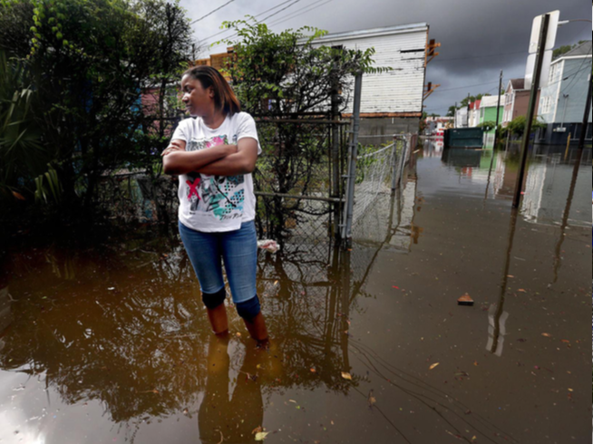
Flood hazards are not equal across urban areas, with some being more prone to flooding due to the presence of impervious surfaces, topography, drainage capacity, and other aspects that affect the circulation of water. Because of this, urban communities may be differently exposed to flooding depending on their location.
People are also differently vulnerable to flooding. Factors such as age, income, poverty, or access to healthcare affect the capacity of people and communities to anticipate, adapt and recover from hazards such as flooding. Environmental injustice of flooding occurs when the distribution of flood hazards disproportionately affects socially vulnerable communities and/or BIPOC communities. For example, impervious surfaces in urban areas tend to be more abundant in vulnerable communities, while green spaces are more scarce than in advantaged neighborhoods. Systematic or historical forms of exclusion or injustice such as the practice of redlining play an important role here as well and have been linked to an unequal distribution of green spaces and heat.
While flood risk is unevenly distributed across differently vulnerable communities, the planning and design of green infrastructure may also affect communities disproportionately depending on where green infrastructure is prioritized, and what it is designed for.
Research Goals
In this project, our goal is to develop a framework that allows us to explore the environmental justice of flooding and green infrastructure planning. Through data visualization and modeling flood risk, we address the following central questions concerning flood risk, and green infrastructure development:
Who is more exposed to flooding?
What benefits (and for whom) are being prioritized in current green infrastructure plans or developments?
Ultimately, our goal is to provide analysis and visualized results of how planned green infrastructure interventions could benefit minority and low-income populations in cities. As part of the development of this framework, we collaborate with local stakeholders and organizations in order to explore how our methods can be adapted to their specific needs and questions.
Methods and Tools
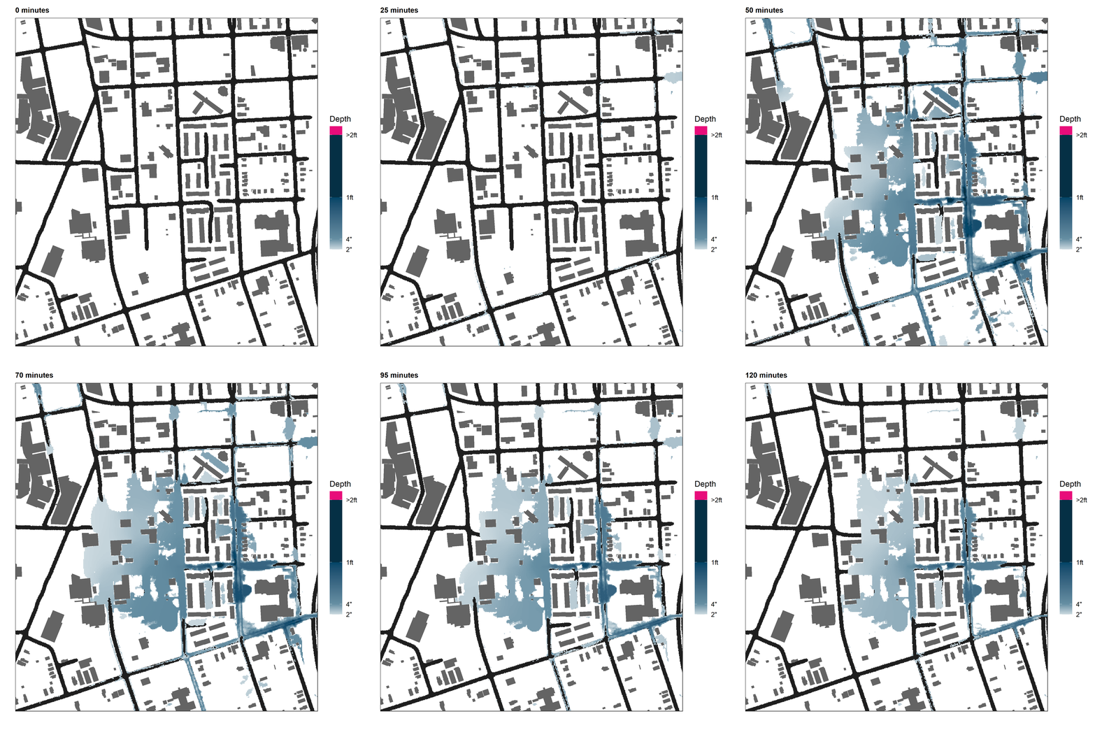
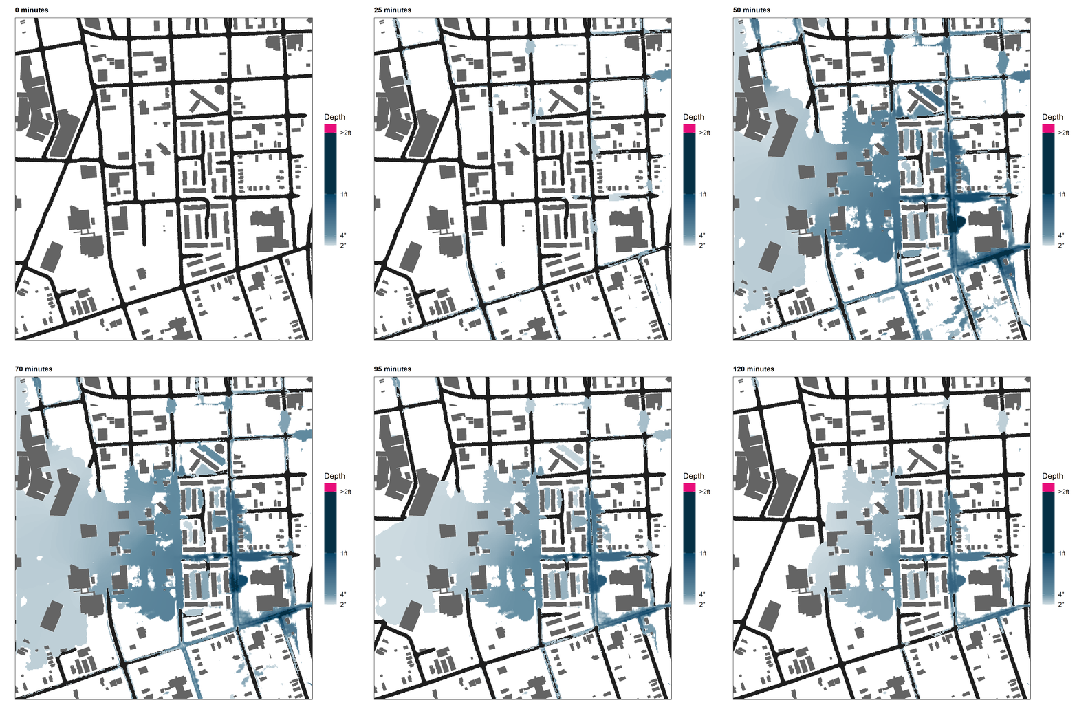
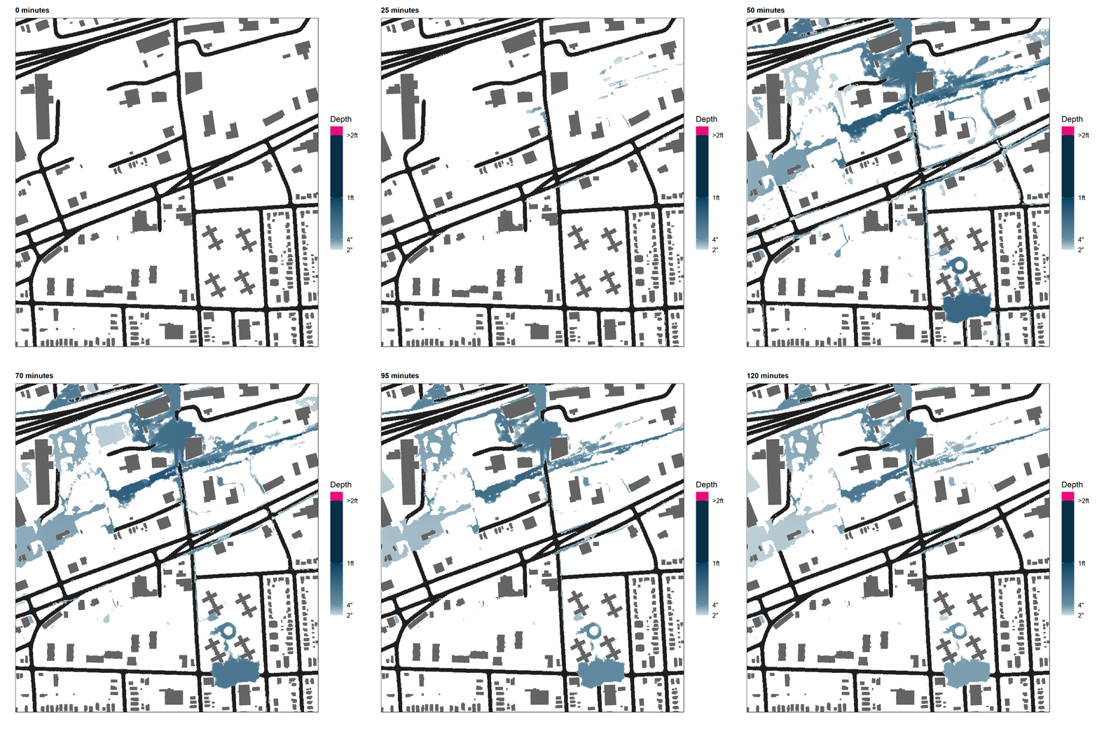
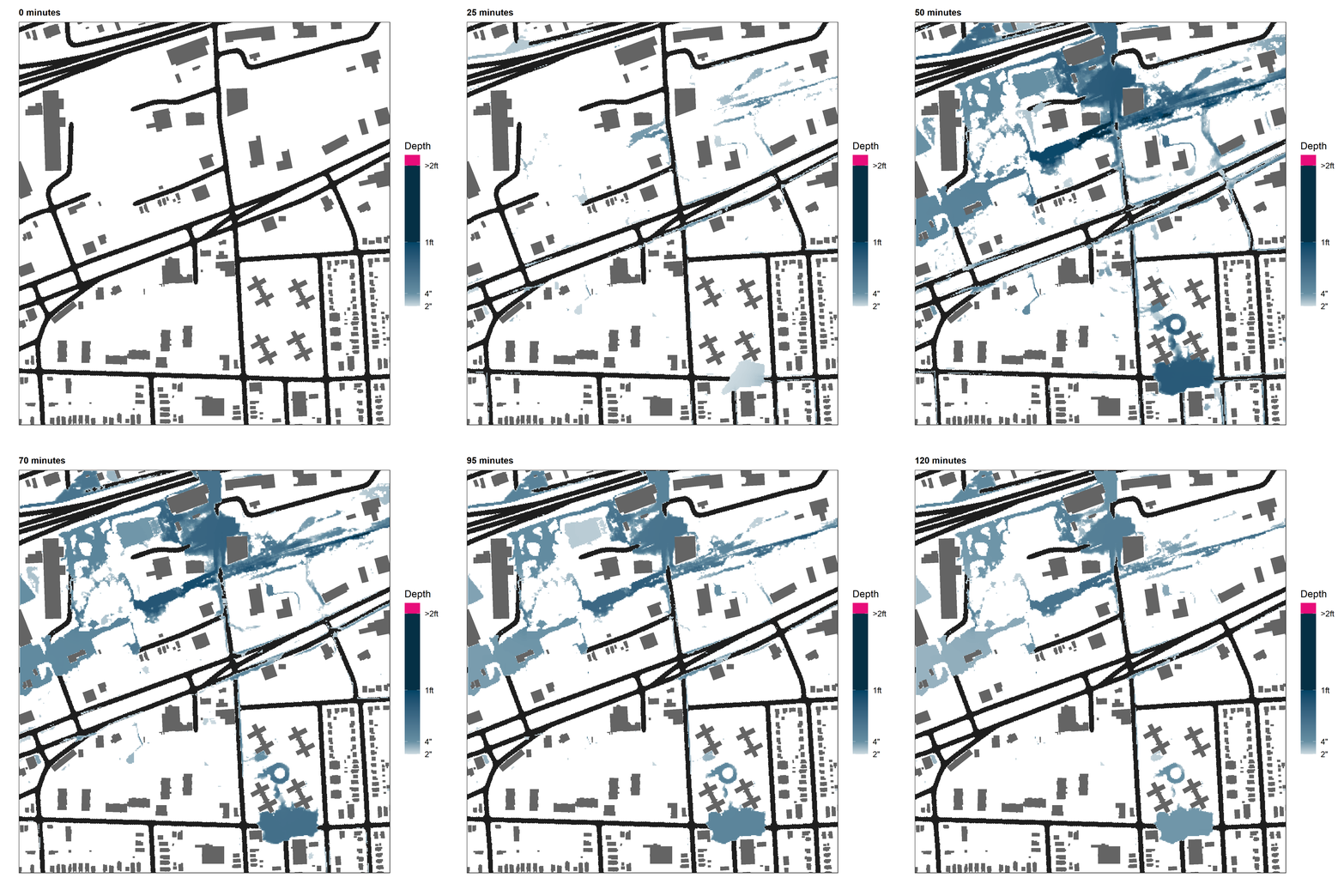
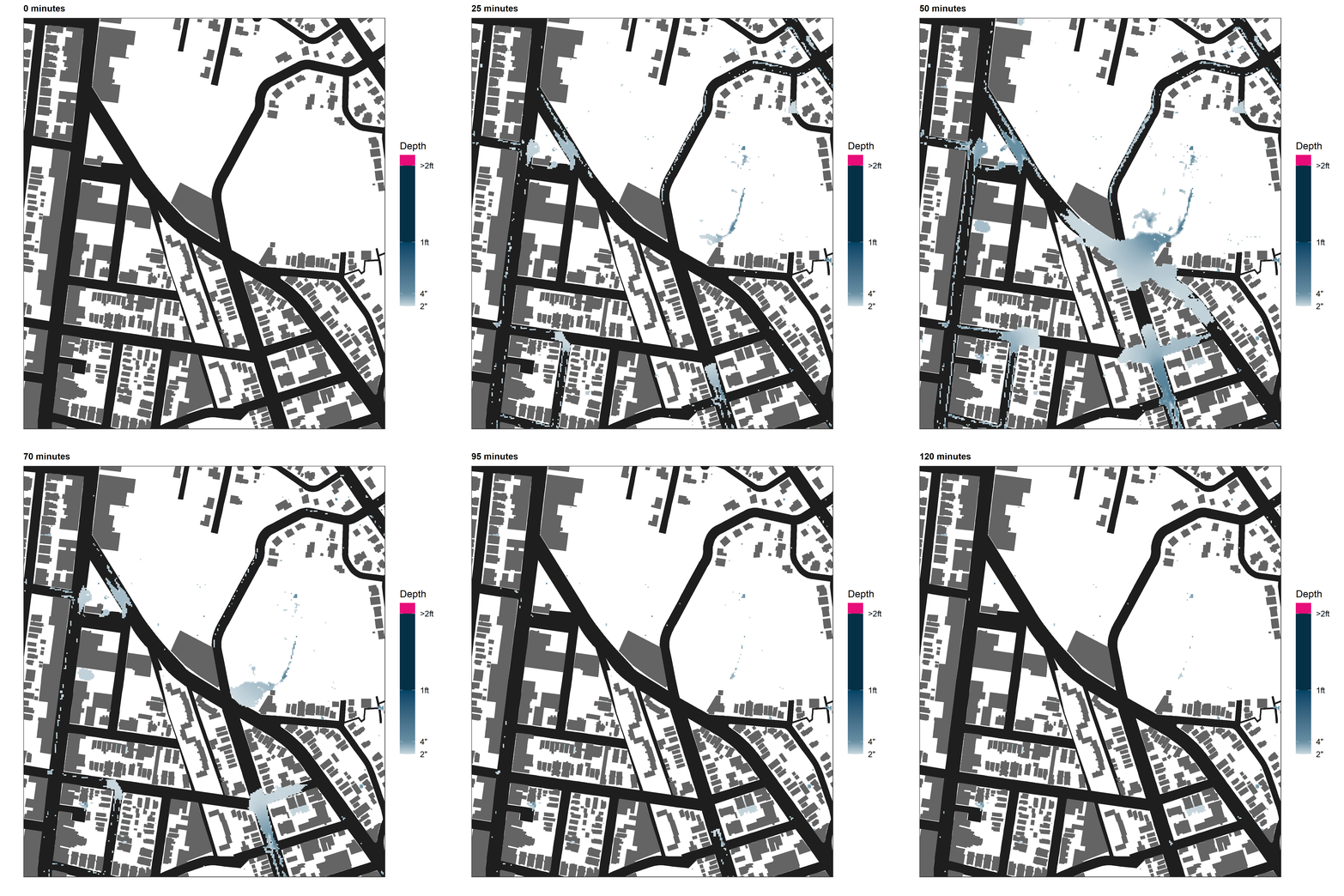
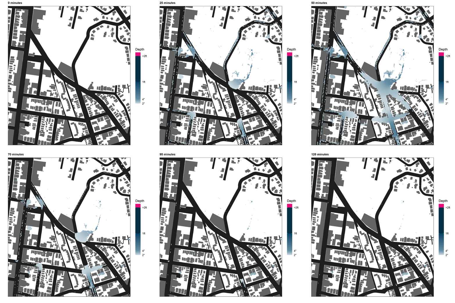
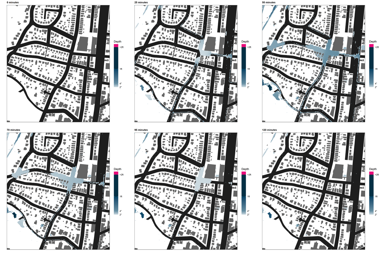
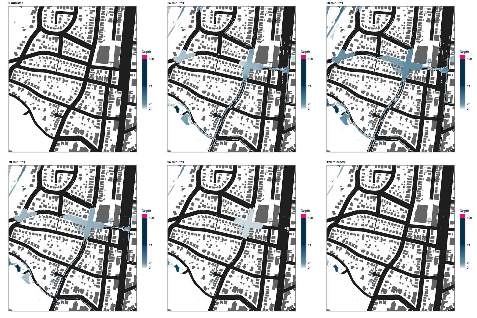
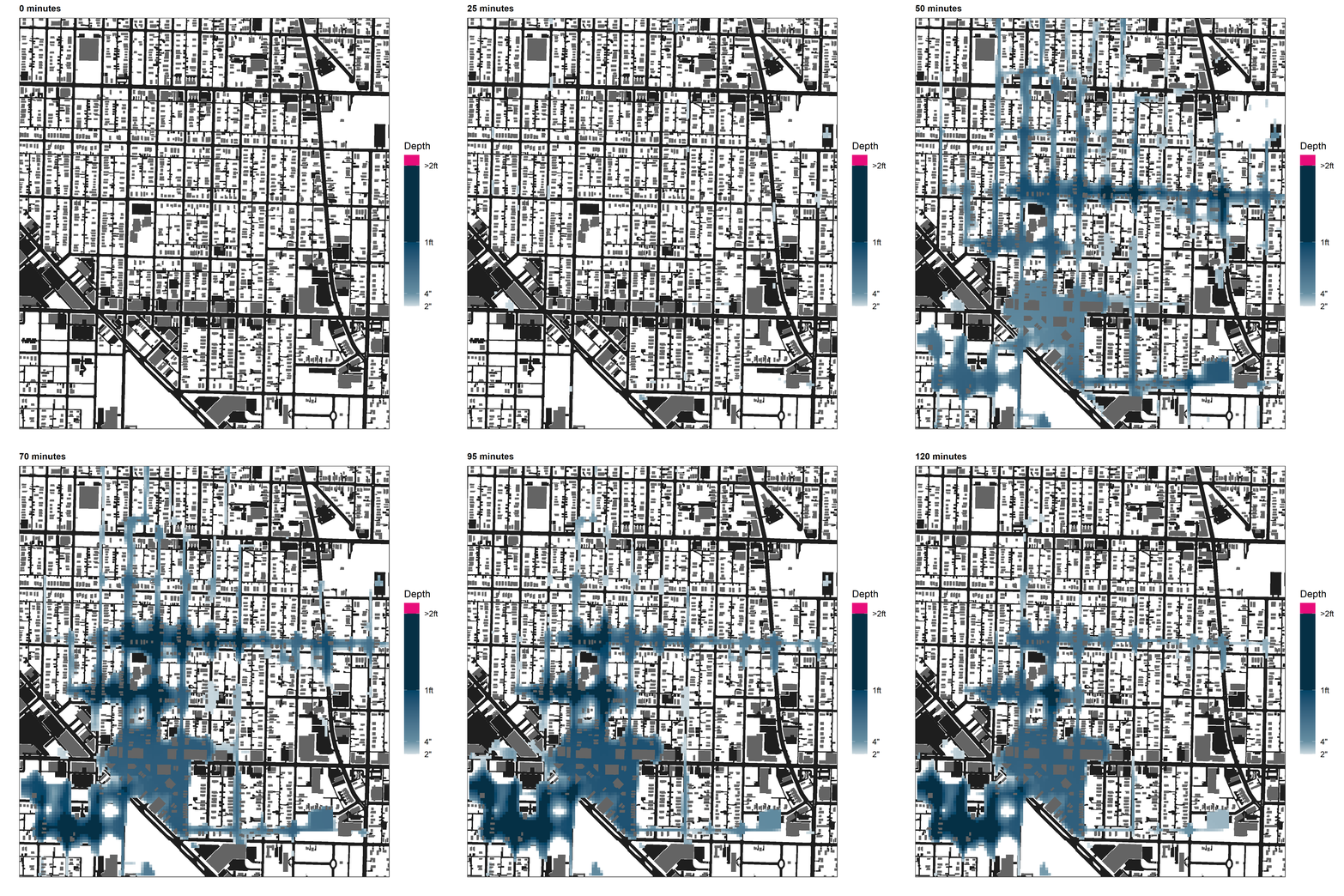
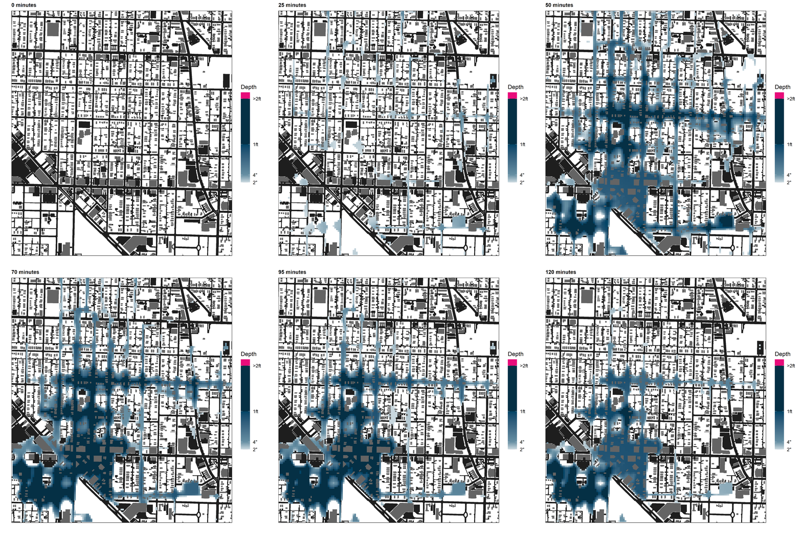
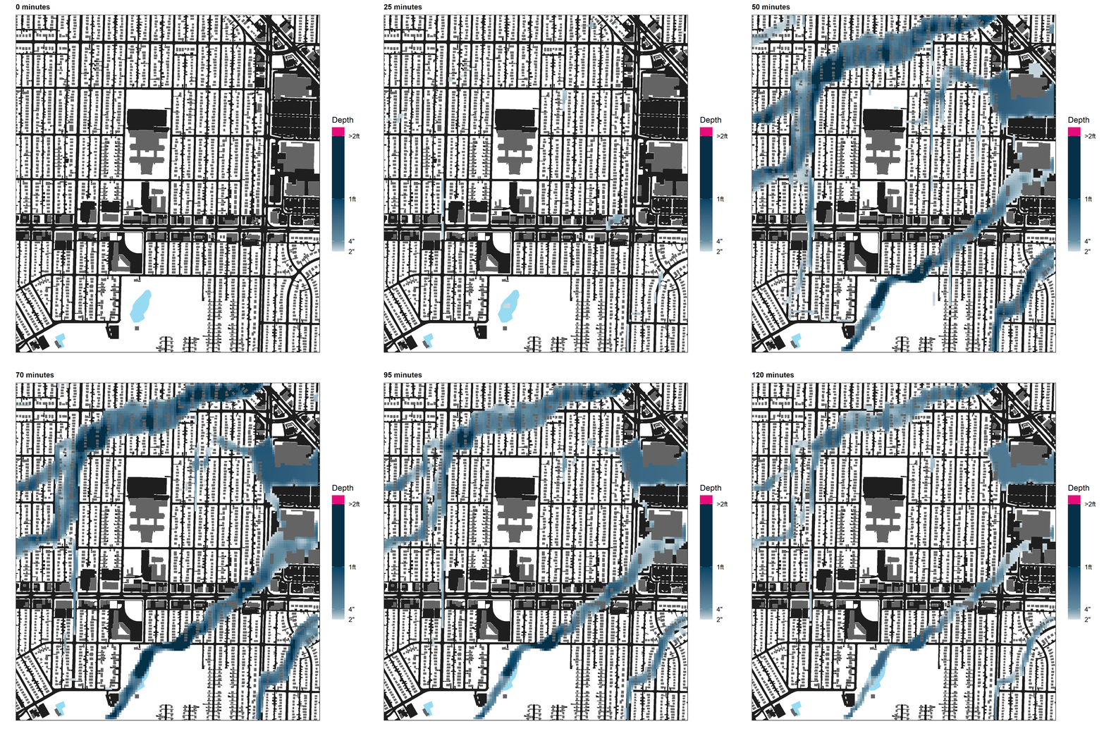
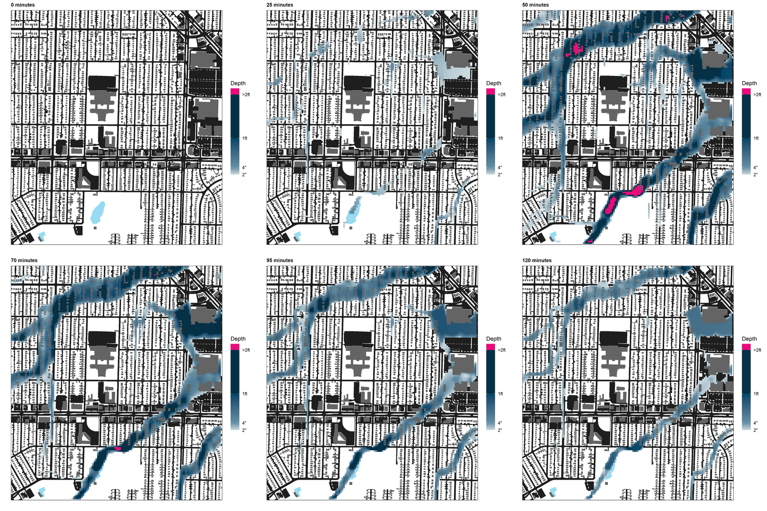
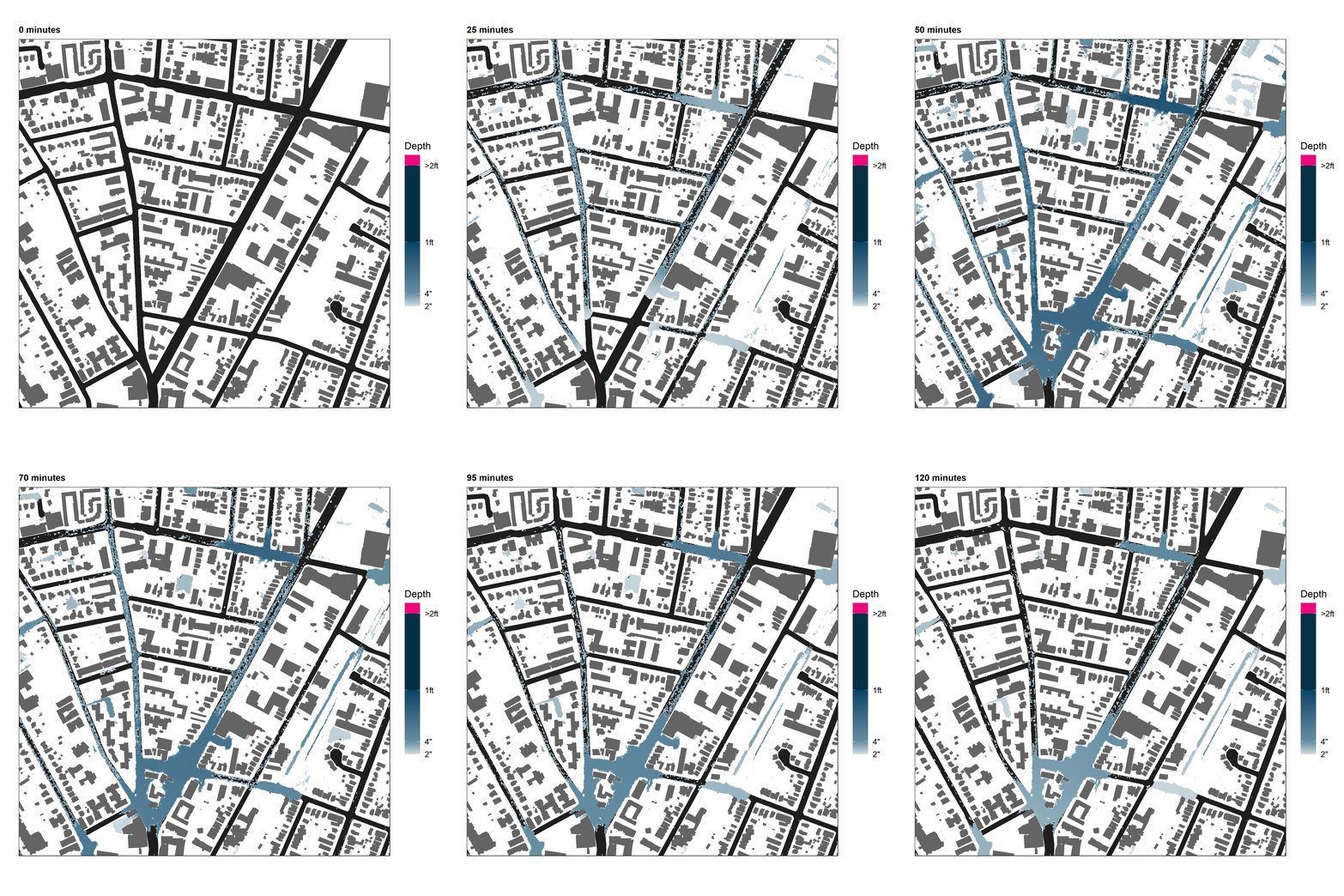
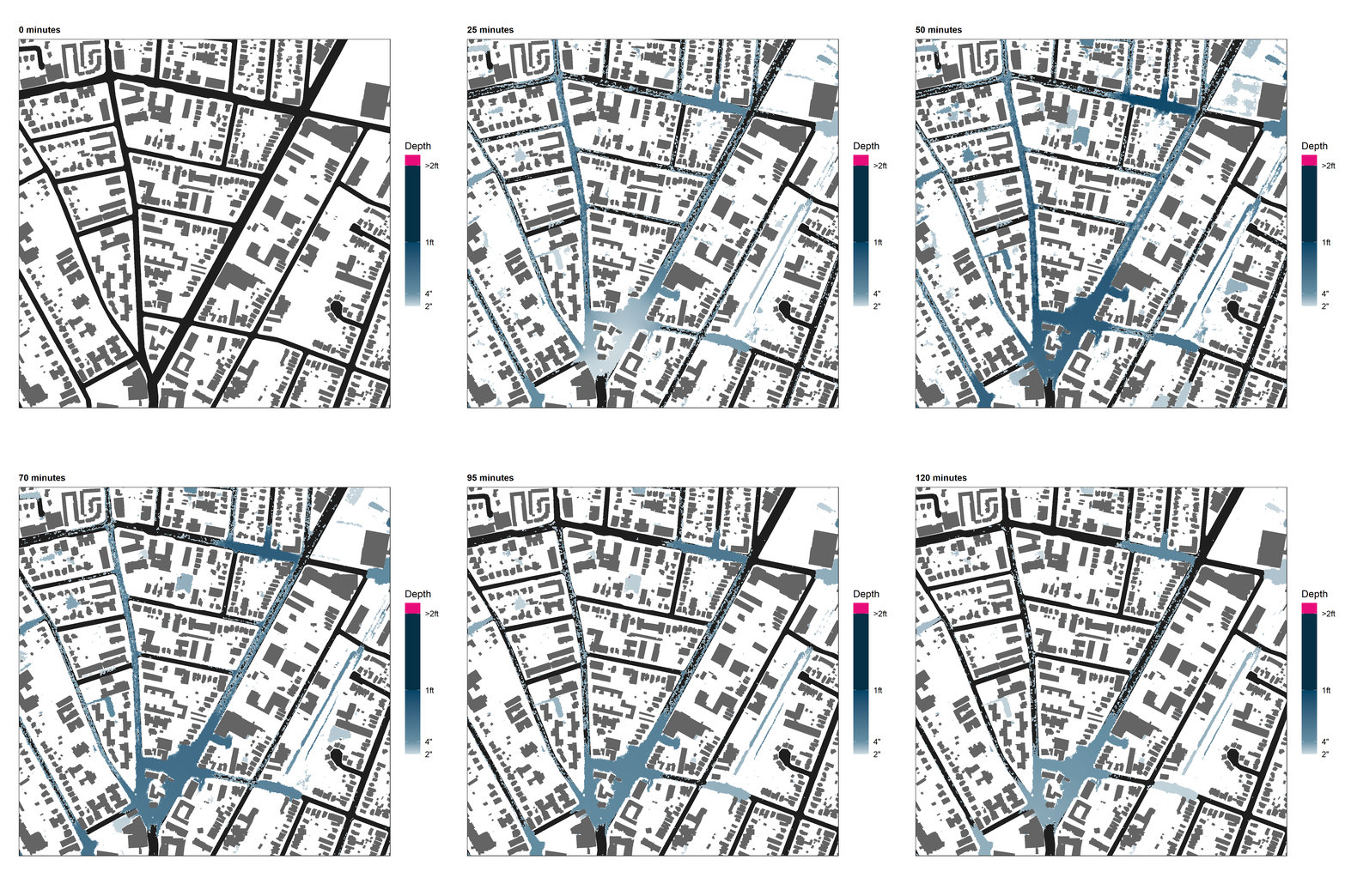
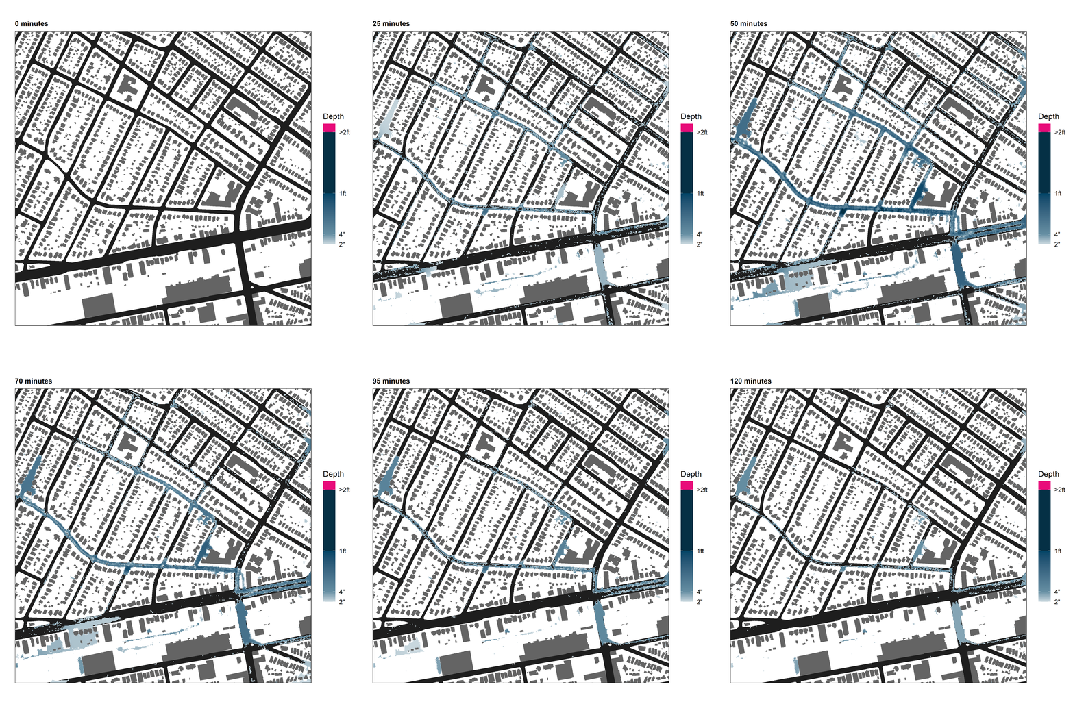
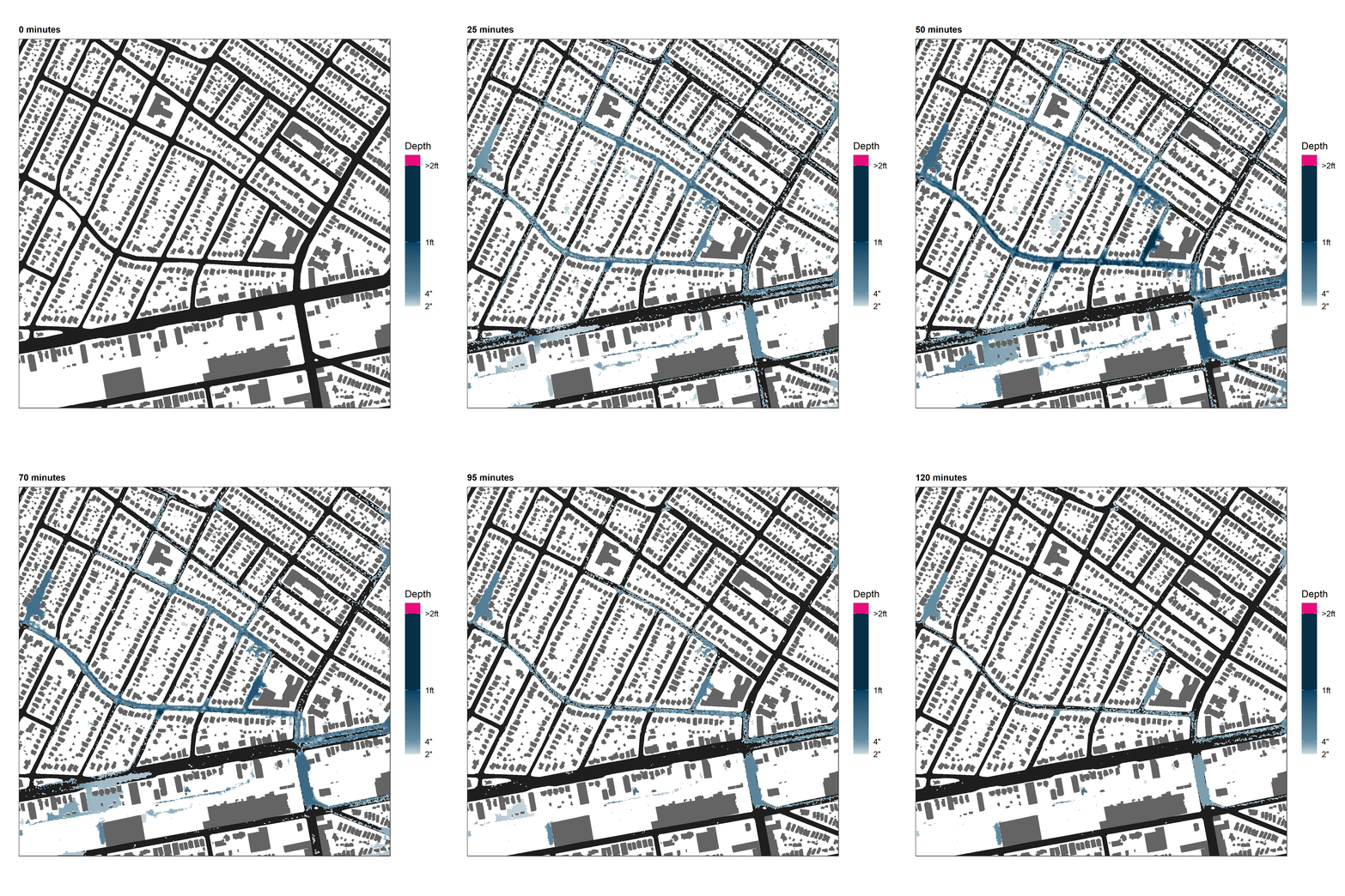
1. Mapping flood risk: To map current flood risk and explore how different scenarios of green infrastructure distribution would change it. For this, we use CityCAT, a hydrodynamic model developed by researchers at Newcastle University. With CityCAT, we simulate storms with different return periods (10 and 100 years), mapping flood depths. Some maps showing different outputs that the map can provide.
Mapping current flood risk to explore how different scenarios of green infrastructure distribution would change
2. Analyzing the distribution of flood risk across communities with different social vulnerability: Once we have map flood risk, we use spatial data analysis to assess the social vulnerability of differently exposed communities. For this, we rely on social vulnerability indicators such as those included in the Social Vulnerability Index developed by the Center for Disease Control (CDC), which is commonly used in hazard mitigation planning. Maps showing gradients of social vulnerability variables (e.g. poverty and race).
3. Visualizing our results in an effective way that enables local stakeholders to understand and use them to achieve their goals: Storymaps, charts, and reports are used for data dissemination.
Sample Flood Modeling in Elizabeth, NJ
Focus Cities
We focus on a group of small to mid-sized cities that deal with flooding due to extreme precipitation events, and that present ongoing decision-making processes related to green infrastructure planning and flood risk mitigation.
Syracuse, NY
Area: 25.0 sq mi
Population (2010): 145,170
Severe and extreme precipitation have historically caused important problems in the city related to water quality and flooding. The combined sewers of the city were releasing loads of untreated water into Onondaga Lake, while flash flood events caused by extreme precipitation flooded the streets of the city, requiring residents to evacuate their homes and leading to the loss of human life. During the decade of 2010, the Save the Rain program supported the installation of hundreds of green infrastructure interventions aiming to reduce the impact of combined sewer overflow discharges. While the project was a huge success and milestone goals related to water retention were reached, the allocation and design of interventions focused on tackling water quality issues rather than flooding.
Yonkers, NY
Area: 18.0 sq mi
Population (2010): 195,976
The City of Yonkers, known to be the second hilliest city in the US after San Francisco, suffers from recurrent fluvial and runoff flooding due to extreme precipitation along the four streams which traverses the City and at its natural urban sinks. Such flood events cause damage to residential properties and public utilities. In addition, unmanaged slopeside runoff creates a risk of mudslides. In 2015, a mudslide caused by heavy rainfall forced more than a 100 senior citizens living in municipal housing to permanently relocate, after the property they lived in was severely damaged. Throughout the years the City, together with the Army Corps of Engineers, implemented several flood mitigation projects along the Saw Mill River and the Bronx River, but similar efforts to mitigate runoff flooding were never made. Lately, the Municipal Housing Authority for the City of Yonkers, together with Groundwork Hudson Valley, a local environmental nonprofit, developed a Green Infrastructure Feasibility Study to reduce flood risk at some of its most vulnerable properties.
Milwaukee, WI
Area: 96.2 sq mi
Population (2010): 594,833
Flooding in Milwaukee has been a common problem throughout the last century, with photographic records dating back to 1928. Several rivers (Milwaukee, Menomonee, and Kinnickinnic, as well as several creeks) converge in the city, which takes up a vast area in which impervious surfaces abound. In addition, the city’s downtown presents a combined sewer. In July 2010, a series of precipitation events during which more than 6 inches fell in just an hour led to flash flooding in parts of the city that caused millions of dollars in damages and thousands of homes flooded due to sewer backups. In response to the need to become more resilient against extreme precipitation, the city of Milwaukee launched its green infrastructure plan in 2019, identifying key areas across the city to prioritize green infrastructure development. Due to its close relationship with water through its rivers and lake Michigan, the city has branded itself as a “water-centric city”. Nevertheless, the city of Milwaukee also holds the uncomfortable label of being the most segregated city in the United States, and one of the worst places for African Americans (39.2% of the city’s population) to live in.
Elizabeth, NJ
Area: 12.3 sq mi
Population (2010): 124,969
Elizabeth’s stormwater management relies entirely on a combined sewer system, and more than 50 overflow discharge events take place in a normal year, whereas the city’s permit only allows for 4. In October 2020, the city’s Long Term Control Plan for its combined sewer system was released. In this plan, long term measures are specified to reduce the number of discharge events and their total discharge volume throughout the coming decades.
City Factsheets
Results and Lessons Learned
In each of the focus cities, we took a common approach to assess exposure to flooding across different socioeconomic variables. For this, we simulated two storms with a duration of one hour and return periods of 10 and 100 years. With the results of these simulations, we then group the census block groups and census blocks of each city according to how impacted they are by flooding. This is done by sorting the census block groups by the percentage of their area flooded, and then breaking them down into 4 groups (quartiles) with a similar number of census block groups in each.
Having grouped the city’s census block groups and census blocks, we then compare the socioeconomic and demographic composition of each group. This allows us to respond to our question “Who is more exposed to flooding?” by assessing the socioeconomic differences between populations that experience different degrees of exposure to flooding, and identifying communities that might be unequally impacted by flooding.
The methods used in each city to model and analyze results are equivalent, but are adapted to their circumstances and needs. For example, Milwaukee’s large area required simulating flood at a lower resolution due to computational limitations.
In addition to the general flood risk assessment, each city’s specific context, and interactions with local organizations and collaborators, led us to exploring different alternative methods to continue exploring the environmental justice of flood risk and green infrastructure.
Storymap: Urban Flooding, Equity and Green Infrastructure
Urban flooding is an increasing challenge that cities face nationally and globally. Flood risk is often disproportionate, with some people facing greater risks and impacts than others. As cities invest in solutions to address urban flooding, will those investments help those most in need? How can race, income and other indicators of disproportionate impacts be taken into account in urban planning in order to make flood mitigation policies and practices more equitable and just?
To address many of these questions the Urban Systems Lab developed a new story map that examines the complexity of urban flood risk and green infrastructure (GI) in Syracuse, NY. We explore the ambitious GI program that Onondaga County has successfully implemented targeting the city’s water quality problems related to the Combined Sewer Overflows (CSO) caused by its Combined Sewer System. We also discuss shortcomings of these efforts related to concerns about inclusion of flood risk reduction and need for more explicit environmental justice (EJ) considerations. By incorporating EJ dimensions more explicitly, the county and the city could further strengthen their green infrastructure initiative, providing protection from flooding to its most vulnerable communities. Based on our research, we propose a methodology that American cities could apply to both incorporate flood risk mitigation in their planning, as well as to prioritize intervening in locations that could benefit vulnerable communities.
News & Updates
December 2022
Release of The Milwaukee Flood and Health Vulnerability Assessment: The Milwaukee Flood and Health Vulnerability Assessment (FHVA) is a collaborative effort between Groundwork Milwaukee and The New School’s Urban Systems Lab to develop an assessment tool which identifies communities across Milwaukee where exposure to urban flooding and pre-existing health, housing and socioeconomic conditions intersect and create disproportionate vulnerabilities to the impacts caused by extreme flooding. The aim of the project is to provide critical information on both flood exposure and social vulnerability to support community-based advocacy and future planning to mitigate potential flood and health risks. Learn more
October 2021
The USL’s work exploring urban flood risk supported by the Kresge Foundation is featured in the latest episode of Amazon’s Fix This, a bi-weekly podcast of bite-sized stories about how tech makes the world a better place.
June 2021
The USL team mapped and analyzed flood risk in Milwaukee integrating social vulnerability indicators, showing a clear overlap in the distribution of flood risk, low income communities, and communities of color. We presented these results to Milwaukee Water Commons (MWC), who are now using this as a tool for advocacy in future urban planning for the city.
More recently we have started to collaborate with Groundworks Milwaukee, providing needed data for citywide flood risk maps which will inform their Climate Safe Neighborhoods program.
May 2021
Our work with GWHV is now supporting a landscaping and GI plan for a senior residents property developed by the Municipal Housing Authority for the City of Yonkers (MHACY), and was included in a feasibility study for green infrastructure developed in collaboration with the Mulford Corporation for Affordable Housing Development and the Yonkers Municipal Housing Authority.
The USL’s urban flood risk maps and models are also being used by GWHV’s youth-led Green Team to identify flood prone areas in Yonkers. View News 12 Video.
March 2021
Presentation at AAG Annual Meeting 2021 on Urban Flood Risk
USL Research Fellow Pablo Herreros Cantis is presenting research from the Environmental Justice of Urban Flood Risk and Green Infrastructure Solutions project at the American Association of Geographers 2021 Annual Meeting. His presentation, “Applying a Source-to-Impact flood risk assessment to identify priority areas for green infrastructure interventions in a sewershed in Syracuse, NY” explores how a hydrodynamic modelling approach could guide the identification of priority intervention areas based on the flood risk mitigation benefits experienced downstream. →
Feasibility Study for Green Infrastructure in Yonkers, NY
Our partners at Groundworks Hudson Valley have just released a new feasibility study for the implementation of green infrastructure within selected housing sites owned and managed by the Mulford Corporation in Yonkers, NY. The Urban Systems Lab’s flood modeling was considered as part of the background analysis (see page 10) within the study.
To learn more and read the full document click here.
January 2021
USL Appeals Elizabeth’s LTCP for Environmental Justice Considerations
In collaboration with key stakeholders (Jersey Water Works, New Jersey Future, Future City Inc, and Ironbound Community Corp) in the City of Elizabeth, the USL team has developed an appeal and set of comments in response to the latest draft of Elizabeth’s Long Term Control Plan (LTCP). In the appeal document prepared, we outline our comments regarding the plan’s environmental justice considerations including our recommendations for making them more consistent, transparent, and transformative.
To read the submitted appeal and comments click here.
NOVEMBER 2020
Presentation of work at the Saw Mill River Water Advisory Board
Groundworks Hudson Valley invited USL to present work at the Saw Mill River Water Advisory Board (SWAB). SWAB is a coalition of government organizations that operate within the Saw Mill River's watershed. An online presentation was provided, followed by a conversation and an exchange of emails with local stakeholders that might be interested in collaborating with us to map flood risk and equity in their communities.
August 2020
USL Partners with Groundwork Hudson Valley
The USL has partnered with Groundwork Hudson Valley to assist in mapping urban flood risk in Yonkers, NY. Through our collaboration, we are identifying sites across Yonkers where green infrastructure for flood risk mitigation will be placed after submitting applications for funding supported by our observations.
February 2020
USL Participates in Climate-Ready CSO solutions forum
The USL’s Pablo Herreros Cantis attended the Climate-Ready CSO solutions forum, a community meeting in Elizabeth NJ attended by community members, engineers, utility directors, environmental advocates, students, design professionals, and media. He participated in the event by placing an open question to the panel on the role of social vulnerability in planning green infrastructure. This question was recorded in the blog post of the event.
Collaboration
Do you belong to an organization or official agency in any of the Focus Cities? Would you like to help us leverage our work to your city’s government and communities? Would you like to see a project like this develop in your city? We would love to hear from you. Contact us at herrerop@newschool.edu
Project Team
Timon McPhearson, The New School
Pablo Herreros Cantis, The New School
Claudia Tomateo, The New School
Elizabeth Cook, Barnard College
Christopher Kennedy, The New School
Zbigniew Grabowski, Cary Institute of Ecosystem Studies
This project is supported in part by the Kresge Foundation’s CREWS program. The Climate Resilient and Equitable Water Systems (CREWS) consists of 24 nonprofits working to advance equitable solutions to climate-related storm and flood impacts on low- income communities in U.S. cities.
